The Michigan Department of Natural Resources and Environment have declared Wednesday as a Clean Air Action Day for Allegan, Berrien, Cass, Kalamazoo, Kent, Livingston, Mason, Muskegon, Oceana, Ottawa, St Joseph, and Van Buren counties. This means that you should avoid activities which lead to ozone formation. Such activities are refueling vehicles or topping off when refueling, using gasoline powered lawn equipment, and using charcoal lighter fluid. Positive activities include car pooling, biking to work, delaying or combining errands and using water based paints. It is recommended that active people, and people with respiratory diseases (for example, asthma) limit prolonged times outside. There is also a Heat Advisory until midnight Wednesday Night for Berrien, Branch, Cass, Hillsdale, Livingston, Midland, Shiawassee, and St Joseph counties. Highs on Wednesday will be in the low to mid-90s, with heat indices (how hot it feels) in the upper-90s to near 100 degrees. With dewpoints and low temperatures in the low to mid-70s, it will feel very hot and humid.

Wednesday, June 8, 2011

SPC Shifts All of the Area Into "Slight Risk"


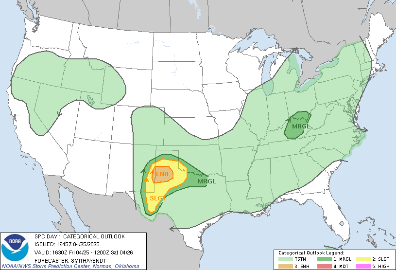
The Storm Prediction Center has shifted the Slight Risk of severe weather into the entire lower peninsula of Michigan with its 12:30 PM update. One storm currently (12:50 PM) between Green Bay and Manitowoc in Wisconsin may be severe in Mason and Manistee counties as it progresses eastward throughout the next hour or two. A line of storms that was trucking along earlier from Iowa and now into southern Wisconsin and northern Illinois has killed itself progressing east. Summing it up, there is a very slight chance of a strong to severe storm through about 4 or 5 PM. Our main threat of storms will enter very late this evening and into the overnight hours. Our main threats are scattered damaging winds and large hail, with an isolated tornado not out of the realm of possibility. The main stuff will be in southern Wisconsin, northern Illinois, northeast Missouri, and eastern Iowa, but a few severe storms here look to be a good possibility. We'll keep you covered throughout the afternoon into the overnight. Always check out our Facebook and Twitter pages for the latest.

~ Forecaster Ben Kouch

Wednesday AM Forecast: One More Day of Heat

Happy Wednesday! Just one more day of this hot and humid weather to put up with. Highs today will be in the low to mid-90s, and I don't doubt some areas will get into the upper-90s. Heat indices will also be near 100 degrees. It's going to actually be a bit hotter than yesterday. Dewpoints are in the 60s today, rather than the 70s we saw yesterday, and it's easier to heat a less moist environment. There's a Clean Air Action Day today, as well as a Heat Advisory. Check for where that's for on the scrolling ticker above. We'll be under Mostly Sunny skies for a large portion of the day. Some storms moving through Wisconsin as I write this (7:10 AM) could bring a few storms into areas like Hart, Pentwater, Ludington, and Manistee as we head through the morning, but the rest of us won't need to deal with any precip until late on. A cold front will bring an end to the heat, but not before sparking some storms very late this evening and tonight. It's a pretty powerful front, knocking our temps down 20 degrees. There's a Slight Risk of Severe Weather north of a New Buffalo to Saginaw Bay line from the Storm Prediction Center. The primary threat will be Large Hail, but there's also a threat for some gusty winds and even an isolated tornado isn't completely out of the question. It is looking like a fairly marginal situation, but we can expect at least a couple severe storms. We'll dry out from north to south on Thursday. In fact, areas south of Grand Rapids could hang on to some rain through about lunchtime. Our next chance of rain will come  Friday and Saturday. This rain chance could bring a fairly decent amount of rain, with an inch or two possible. This will add to the worries on the rivers. We still have Flood Advisories for the Grand River at Ionia, the Maple River at Maple Rapids, the Portage River at Kalamazoo, and the St Joseph River at Burlington.

~ Forecaster Ben Kouch

Tuesday, June 7, 2011

Rip Current Safety

This is rip current awareness week, so here's some info for you from NOAA on how you can stay safe.

Here's a real-life story on rip currents from the director of the southern region of the National Weather Service- 
"Hi. My name is Bill Proenza and I am the Director for the Southern Region of the National Weather Service. My experience with rip currents is first hand. At the age of 11, I was swimming off the Florida Coast, near Key Biscayne, and found myself carried into deep water. I tried to swim toward shore but to no avail. After being pulled under the water once, I called for help. Fortunately, an experienced swimmer pulled me to safety. Following this event, I took lessons through the Red Cross swimming program. While the program helped me improve my swimming ability, it did not offer much insight on handling what we called "undertows" (rip currents). Nevertheless, the training did pay off two years later, when I had the chance to save a man who was trapped in a rip current, again off Florida's east coast. I noticed him struggling in the water and crying out for help. I swam behind him and managed to push him at an angle toward the shore. He told me he couldn't swim but found himself drawn into deeper and deeper water. It is my hope that you take these safety rules and the dangers of rip currents to heart. If you do so, your trips to the coast should be pleasant, enjoyable and safe for you, your family and friends."

For tons of more stories, check this out- http://www.ripcurrents.noaa.gov/real_life.shtml


On the left is a look at what beach warning flags mean. Safety tips and more available at http://www.ripcurrents.noaa.gov/tips.shtml

~ Forecaster Ben Kouch

SPC Puts Us in Slight Risk for Wednesday


The Storm Prediction Center's 1:30 PM update has included areas north of a New Buffalo to Saginaw Bay line in a Slight Risk of Severe Weather on Wednesday. Storms are expected to initiate in Wisconsin and progress towards us by Wednesday evening into the overnight hours. It's looking more likely we'll see development for Wednesday than we did last night. In fact, there wasn't much development even on the other side of the lake last night. For the threat Wednesday evening/night, we could see some scattered large hail and wind damage. The threat isn't looking super bad, as the worst of it will be in Wisconsin, northern Illinois, and northeastern Iowa. Locally heavy rainfall is also a possibility. We'll keep tracking it for you!

~ Forecaster Ben Kouch

Tuesday AM 5-Day Forecast

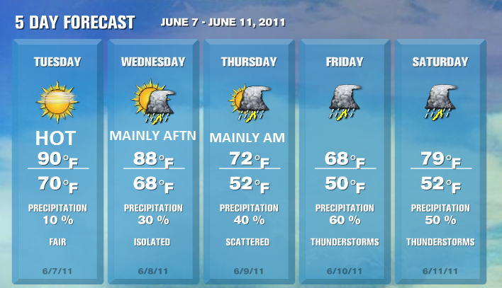
We're looking at a hot stretch of weather for today and tomorrow, with highs in the low to perhaps mid-90s. We have a Heat Advisory for Livingston, Midland, and Shiawassee counties for both today and tomorrow. Today is also a Clean Air Action Day for Allegan, Barry, Berrien, Cass, Kalamazoo, Kent, Mason, 
Muskegon, Oceana, Ottawa, St Joseph, and Van Buren counties. This is likely to also 
be the case on Wednesday. Highs will be in the upper-80s on Wednesday, and a 
Clean Air Action Day will also be possible tomorrow.

Capture-87.png
~ Forecaster Ben Kouch

Monday, June 6, 2011

Severe Weather Possible Tonight

The Storm Prediction Center has included areas north and west of a South Haven to Lansing line in a Slight Risk of Severe Weather tonight.


Storms are expected to push into the area between 8 PM and 4 AM, after developing in Wisconsin. They'll have an east-southeasterly movement. Here's a look at CAPE (Convective Available Potential Energy) and LI's (Lifted Indices), measuring instability. Although the best numbers are on the other side of the lake, they're fairly decent here, with CAPE around 2000-2500 j/kg and LI's around -5 to -7.
NAM CAPE forecast valid 00 UTC Tue 07 Jun 2011

NAM PLI forecast valid 00 UTC Tue 07 Jun 2011

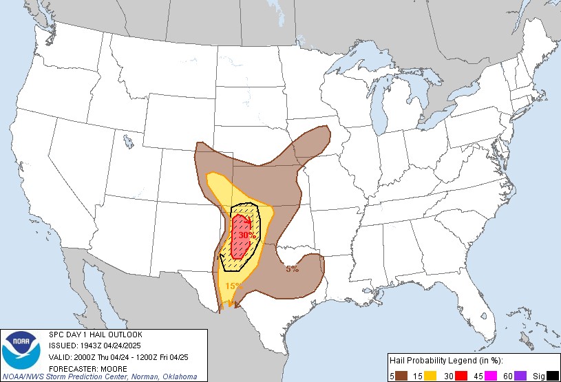
Damaging Winds and Large Hail are the primary risk, as noted by the Storm Prediction Center's risk for these two severe threats. I've just posted the hail, as the risk looks the exact same for hail/wind, at least in our area.

There could also be some locally heavy rainfall. Stay tuned to the latest from our Facebook page and the broadcast room if severe weather does occur.

~ Forecaster Ben Kouch