
The Storm Prediction Center has included areas north and west of a South Haven to Lansing line in a Slight Risk of Severe Weather tonight.
Storms are expected to push into the area between 8 PM and 4 AM, after developing in Wisconsin. They'll have an east-southeasterly movement. Here's a look at CAPE (Convective Available Potential Energy) and LI's (Lifted Indices), measuring instability. Although the best numbers are on the other side of the lake, they're fairly decent here, with CAPE around 2000-2500 j/kg and LI's around -5 to -7.


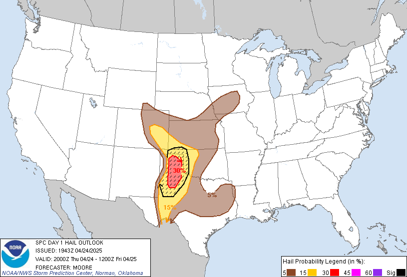
Damaging Winds and Large Hail are the primary risk, as noted by the Storm Prediction Center's risk for these two severe threats. I've just posted the hail, as the risk looks the exact same for hail/wind, at least in our area.
There could also be some locally heavy rainfall. Stay tuned to the latest from our Facebook page and the broadcast room if severe weather does occur.
~ Forecaster Ben Kouch
No comments:
Post a Comment